Zei C., Tarabusi G., Ciuccarelli C., Burrato P., Sgattoni G., Taccone R.C., Mariotti D. (2024) - CFTIlandslides, Italian database of historical earthquake-induced landslides. Istituto Nazionale di Geofisica e Vulcanologia (INGV). https://doi.org/10.13127/cfti/landslides
The database was designed and developed by Gabriele Tarabusi ![]() and compiled by all the authors, based on a revision of CFTI5Med data, conducted within the activities of the CFTI working group.
and compiled by all the authors, based on a revision of CFTI5Med data, conducted within the activities of the CFTI working group.
The webgis interface was designed and developed using the OpenLayers (https://openlayers.org/) library and its extensions “OL-ext” (https://viglino.github.io/ol-ext/) and “OL-Cesium” (https://openlayers.org/ol-cesium/) by Gabriele Tarabusi ![]() with contributions by Rita Chiara Taccone
with contributions by Rita Chiara Taccone ![]() (technical and system support).
(technical and system support).
The research underlying this database has been significantly improved by valuable contributions of Giovanna De Francesco, Sofia Baranello and Rosa Maria Sava. Through thesis and internship activities, it also involved the participation of Alessandra Bachiorri, Giorgio Bonavita, Gabriele Di Iorio, Alessandra Gaspari, Francesco Lo Muto, Lorenzo Rosati, Elisa Sulsenti, Benedetta Trotta.
Knowing the location, the extent and the characteristics of any earthquake-induced environmental phenomena is becoming an increasingly pressing need for civil protection agencies and local administrations. In particular, earthquake-triggered landslides may cause significant losses and may delay rescue operations across large areas.
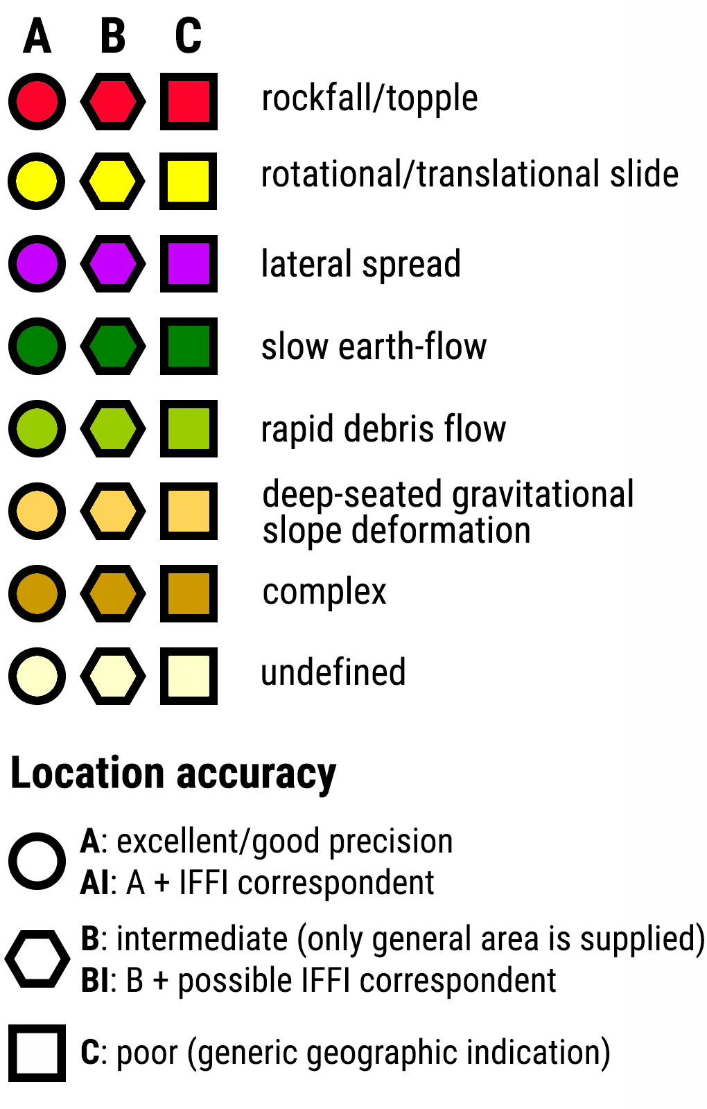
The CFTIlandslides was designed as "work in progress", and as such it is open to later additions and improvements in future releases. This first version of the database features over 1,000 landslides, subdivided into classes based on location accuracy and type of movement. It is addressed to a large audience of potential users, including researchers and scholars, administrators and technicians belonging to local institutions, and civil protection authorities.
| |
With the exception of the data provided by third parties via web services, for each of which the reader must refer to the specific user license indicated in the legend, all data of the CFTIlandslides are offered with a Creative Commons Attribution 4.0 International license (CC BY 4.0). This license requires that any reutilization of data from this database must give the necessary credit to the authors |